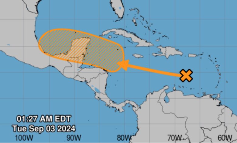
After a period of calm, Jamaica is set to face a tropical wave within the next 48 hours, bringing showers, gusty winds, and possible thunderstorms to the island. The southern coast is predicted to be most affected, as the wave, currently moving west-northwestward through the Caribbean Sea, approaches.
According to forecasts from Tuesday morning, rainfall is expected to begin in parts of eastern Jamaica on the morning of Tuesday, September 3, 2024, and will likely extend to central and western regions by the afternoon.
For Jamaica, this wave comes almost two months after Hurricane Beryl, the earliest Category 5 Atlantic hurricane in history, which struck Jamaica on July 3. Beryl was between category 3 and 4 when it affected Jamaica, per reports.
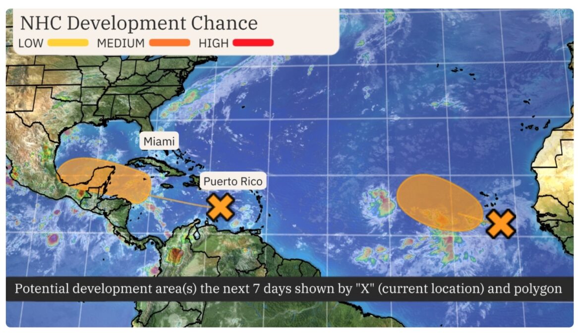
The National Hurricane Center is currently monitoring two systems, both of which have a good chance of developing into tropical depressions over the next week. However, the system closest to Jamaica is not expected to develop into a tropical depression before reaching the island.
The second system is off Africa’s west coast, moving towards the Caribbean.

Notably, neither system poses an immediate threat to land. Tropical development is possible later this week or over the weekend as most western systems reach the northwest Caribbean and southwest Gulf of Mexico waters.
Beryl caused significant damage, particularly along the south coast, with St. Elizabeth among the worst affected. Some areas have only just regained power in the aftermath of the storm. As Jamaica prepares for this new weather event, the memories of Beryl’s devastation remain fresh.
[ads3]
RELATED


