Tropical Storm Ian is Getting Stronger – Watch Latest Tracking Video
Heavy rainfall is expected to affect Jamaica as tropical storm Ian is currently projected to pass south of the island by Sunday.
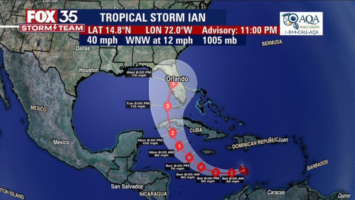
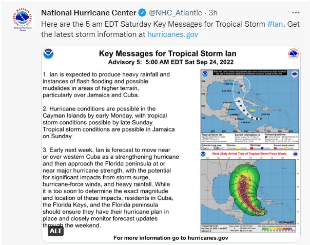
There are currently four named systems in the Atlantic/Caribbean Sea: tropical storms Ian, Gaston, and Hermine, and tropical cyclone Fiona. With Hermine along the African coastline, meteorologists are now tracking the tropical storm Ian as it travels through the Caribbean Sea. Quickly moving to the west with a speed of 14mph, the National Hurricane Center (N.H.C) of the United States has projected heavy rainfall, flash flooding, and possible landslides in areas of higher terrain over Jamaica and Cuba.
The Meteorological Service Division of Jamaica has since informed the public that a Tropical Storm Watch remains in effect for the island, as tropical storm conditions pose a possible threat to Jamaica within the next 48 hours. All small craft operators, including fishers, are advised to remain in safe harbour until sea conditions return to normal and warning messages have been lifted.
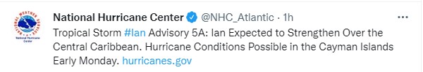
With high amounts of heat in sections of the Caribbean fueling tropical storm Ian, the system may intensify into a hurricane by the time it passes Jamaica and approaches the Cayman Islands early Monday morning. The N.H.C has reported that it is still too soon to determine the magnitude and impact of Ian if it makes landfall as a hurricane, but the storm is projected to move near or over Cuba as a strengthening category two hurricane before reaching Florida at or near major hurricane strength at category three.
View the weather report below.
RELATED: Jamaica On Code Orange Alert For Hurricane
RELATED: Tropical Storm Expected to Affect Jamaica on Sunday
RELATED: Category 1 Hurricane ‘Fiona’ Currently Wreaking Havoc In Puerto Rico – Watch Video