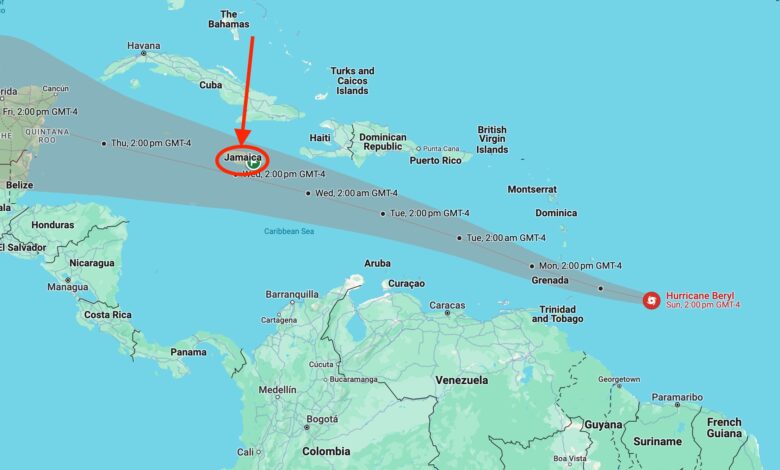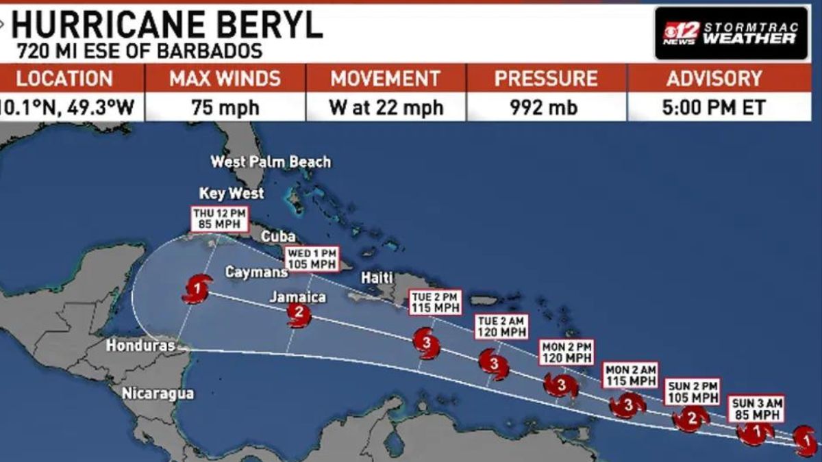
On Sunday, Hurricane Beryl became the first hurricane to strengthen to category 4 in June in the Atlantic Basin, and its eye (centre) is projected to pass just south of Jamaica in the next few days.
According to Javed Hudson, Duty Forecaster at Jamaica’s National Met Service, Beryl is currently heading in the direction of Barbados and the Windward Islands. The dangerous weather system is currently projected to start affecting the islands on Monday.
Regarding its potential effects on Jamaica, Beryl is expected to make its closest approach on Wednesday during the day, with its eye projected to pass to the south of the country. However, Hudson shared that the hurricane is likely to weaken to category 3 or 2 as it passes Jamaica.

Jamaicans have been advised to prepare for Beryl, as the effects of the system, such as heavy rainfall, may begin as early as Tuesday night. The bulk of the system’s effects will be felt throughout the day on Wednesday.
“Do your preparations as quickly as possible because this is a very serious event and also a bit unprecedented. It’s the earliest we’ve had a major hurricane during the season in recorded history because we’re still in late June, early July.”
“We don’t typically see something this strong or this far out at this time of year. So it’s definitely a bit unprecedented and definitely very unusual,” Hudson said while speaking with the TVJ news centre.
Listen to the weather report below.
RELATED
- Jamaica On Code Orange Alert For Hurricane
- Jamaica Advised to Stay on Alert as New Area in The Caribbean is Monitored; Potential Storm or Hurricane
- Hurricane Beryl Expected to Develop into Category 4 by 10 AM on Sunday; Expected to Impact Jamaica on Wednesday – See Report


