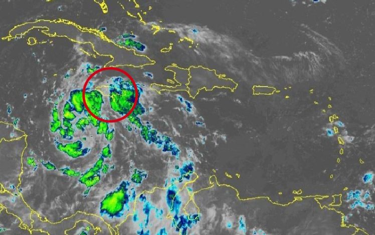
As Tropical Storm Ian, which was previously predicted to affect Jamaica, continues on its new course further away from the island, Jamaica is still expected to receive a fair amount of rain. The Meteorological Service Division has issued a Flash Flood Warning, alerting everyone in flood-prone areas in Middlesex and Surrey parishes.
In a tweet, MetServiceJA announced that a “Flash Flood WARNING is now in effect for flood-prone areas of St. Mary, Portland, St. Thomas, Kingston, St. Andrew, St. Catherine and Clarendon.” The tweet added that “a Flash Flood WATCH is effective for similar areas of Manchester, St. Elizabeth and Westmoreland.”
Meanwhile, reports on Tropical Storm Ian state that the storm is currently southwest of Jamaica. Ian is expected to develop into a hurricane later today into tonight. According to the prediction presented by the National Hurricane Center, the storm will gradually turn to the north and intensify into a hurricane. It is predicted to move over or very close to the western tip of Cuba, where it might become a very strong hurricane. Continuing along its path, it will emerge into the eastern Gulf of Mexico and move towards Florida.
RELATED: Major Flooding in St. Mary
RELATED: Tropical Storm Watch Discontinued as Ian Retreats from Jamaica
RELATED: Tropical Storm Ian is Getting Stronger – Watch Latest Tracking Video


